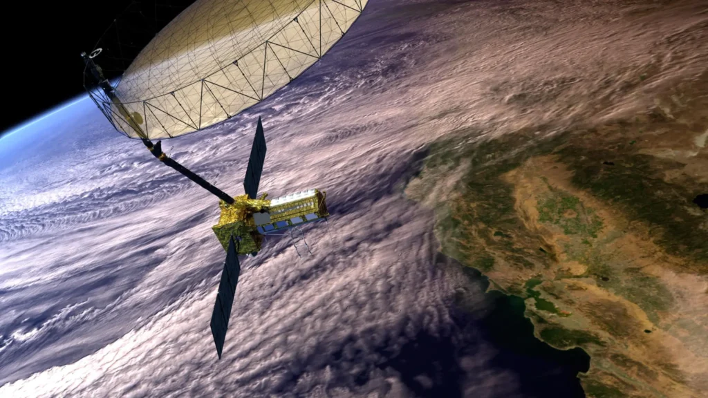
nisar-earth-observation-satellite-nasa-isro cdrit by nasa isro .com
Explore the complete details of NASA-ISRO’s joint NISAR mission. Know its $1.5 billion cost, July 2025 launch timeline, cutting-edge radar technology, and the mission’s real-world benefits for climate change monitoring, disaster management, agriculture, and more. A must-read for every space enthusiast!
🌍 Welcome to the Future of Earth Observation
In the world of advanced Earth science and satellite technology, NASA and ISRO are coming together to create history. Their joint mission, NISAR (NASA-ISRO Synthetic Aperture Radar), is set to launch in July 2025. With a budget of $1.5 billion, this will be one of the most expensive and advanced Earth-observing satellite missions ever built. But why is it so important? Let’s break it down in human terms.
1: What is NISAR Mission?
NISAR is a dual-frequency radar satellite that will orbit Earth to monitor changes in the planet’s surface — from glaciers melting to earthquakes forming, from forest cover loss to soil moisture.
2: NISAR’s Full Form
NISAR = NASA-ISRO Synthetic Aperture Radar
3: Who is Building NISAR?
- NASA is providing the L-band radar, communication system, and spacecraft bus.
ISRO is building the S-band radar, launch vehicle (GSLV), and mission operations.
4: Why is It Special?
It’s the first satellite that uses dual-frequency SAR (L-band and S-band) together, allowing it to monitor Earth changes in real time and with ultra-high precision.
1: NISAR Launch Date & Mission Cost
| Mission Element | Details |
|---|---|
| Launch Date | Expected July 2025 |
| Launch Vehicle | GSLV Mk II (from Sriharikota, India) |
| Total Cost | $1.5 Billion (₹12,500 Crore approx.) |
| Orbit Type | Sun-synchronous Low Earth Orbit (~747 km) |
| Mission Life | Minimum 3 years |
2: Funding Breakdown
- NASA’s Contribution: ~$950 million
- ISRO’s Contribution: ~$550 million
🌋 1: Key Objectives of NISAR Mission
NISAR is designed to scan the entire planet every 12 days. Its goals include:
2: Main Scientific Objectives
- Track glacier movement and ice melt (for climate change studies)
- Monitor deforestation and land use changes
- Detect and predict earthquakes and volcanoes
- Measure crop growth and soil moisture (agriculture support)
- Monitor urban expansion and infrastructure shifts
3: Global Coverage with Local Impact
Though global in design, NISAR will be a boon for India in:
- Himalayan glacier tracking
- Earthquake-prone zones (e.g., Himachal, Assam)
- Smart agriculture using real-time land data
1: Real-World Benefits of NISAR – Explained
| Sector | Benefits from NISAR | Example Use Case |
| Environment | Track deforestation & reforestation efforts | Amazon, Western Ghats |
| Disaster Mgmt | Early warning for quakes & landslides | Himalayan states, NE India |
| Agriculture | Crop health & water usage data | Smart irrigation in Punjab, Telangana |
| Glaciology | Monitor melting glaciers & rising sea levels | Antarctica, Ladakh, Arctic |
| Urban Planning | Track city growth, land shifts | Smart city planning, infrastructure upgrades |
1: What Makes NISAR Stand Out Globally?
2: Unique Technologies
- Dual-band SAR (L + S-band): unmatched detail
- 360 TB of data annually: Earth’s largest radar data collection
- Open data access: Will be free for researchers and institutions
3: Collaborators
- NASA (USA)
- ISRO (India)
- Jet Propulsion Lab (JPL)
- URSC Bengaluru
1: Final Thoughts
The NISAR mission is not just a satellite—it’s a space-powered mirror of Earth’s dynamic systems. Whether it’s melting glaciers in the Himalayas or soil health in Indian farms, this satellite is set to give scientists and decision-makers unparalleled insight.
🌟 Want to stay updated on this mission? Bookmark this blog and follow VeenaSpace.com for regular updates, space news, and more insightful posts.
